blah blah blah
Table Mountain
Length: 4.0 miles out-and-backDifficulty (click for info): Moderate
Elevation Gain: 1420 feet
Rating (click for info): 7/10
Elevation: 2675'
Prominence: 495'
Driving Directions:
Trailhead and parking area are on Bear Notch Road in Bartlett, NH. (Seasonal road - check status on TrailsNH to verify gate status). If approaching from the north, take Bear Notch Road off the south side of Rt. 302, 6.2 miles west of Rt. 16 in Glen. The trailhead is 1.7 miles up the road. If approaching from the south, take Bear Notch Raod from the north side of Rt. 112, 12.2 miles west of Rt. 16 in Conway. The trailhead is 6.2 miles up this side of the road. Look for a small dirt pull-off on the east side of the road, adjacent to the road's crossing of Louisville Brook. Click here for a Google map.
About the Hike:
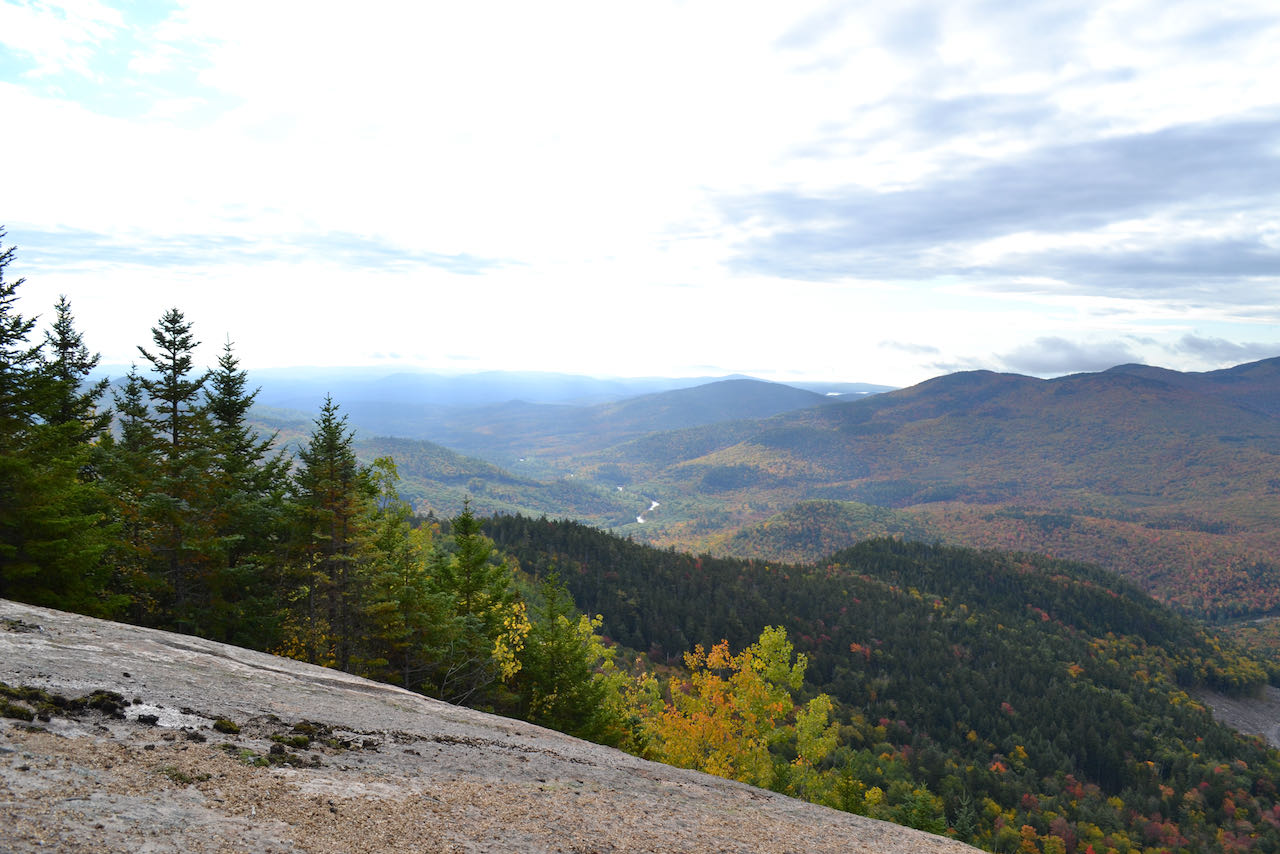
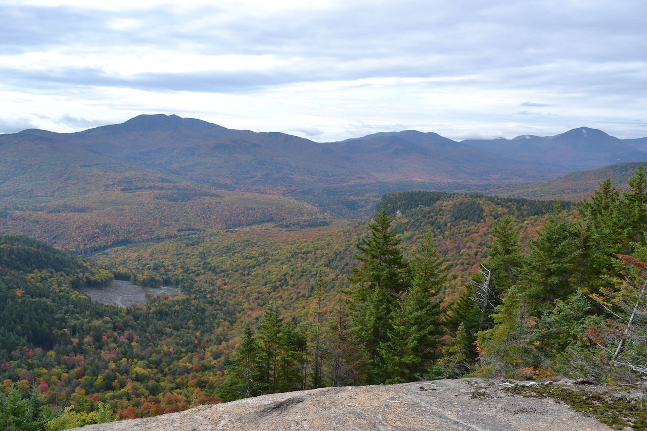
Table Mountain is one of the lower summits of the Moat Range. It is not a particularly distinctive mountain, nor is it clear why it is supposed to resemble a Table. The mountain was one of the more obscure destinations in this region of the Whites, but its recent inclusion on the 2020 revision of the famous 52-With-a-View list has boosted its popularity. Table's summit ridge has a string of scenic open ledges which offer fine views of the eastern Sandwich Range and Swift River Valley, which are especially suitable for fall foliage viewing. These ledges can be accessed with a modest effort via the Attitash Trail, which crosses the mountain and has its western terminus on Bear Mountain Road.
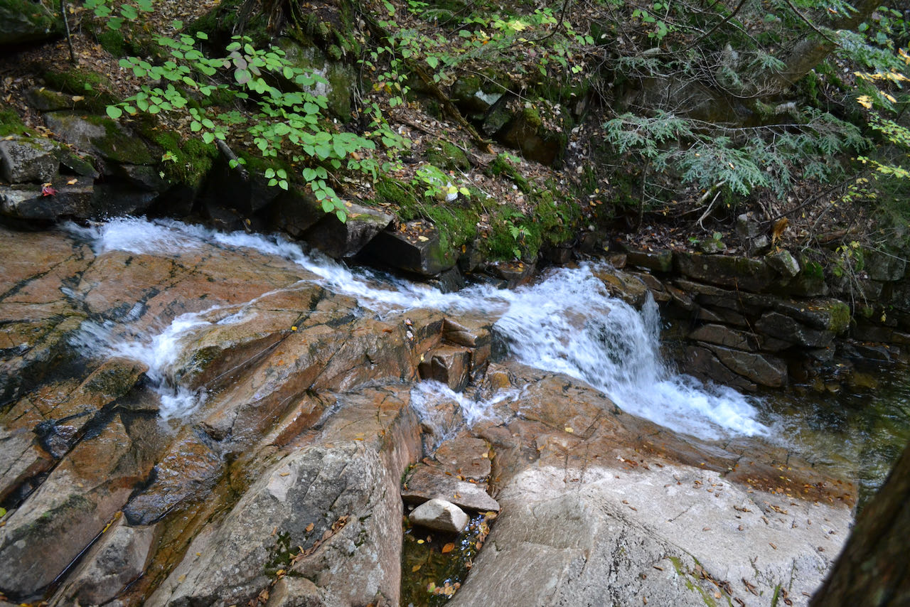
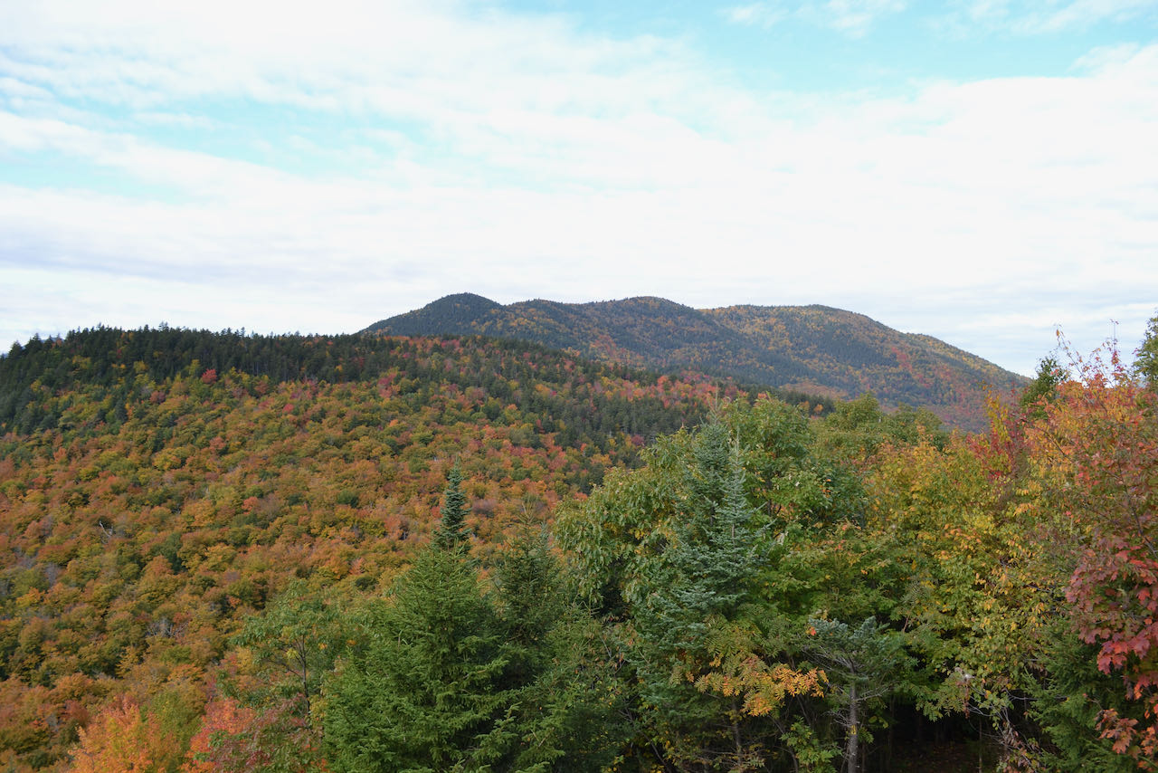
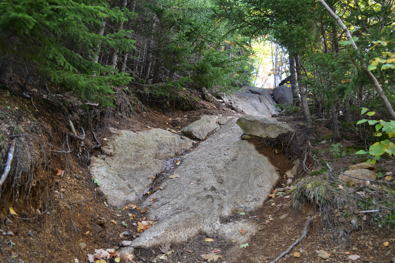
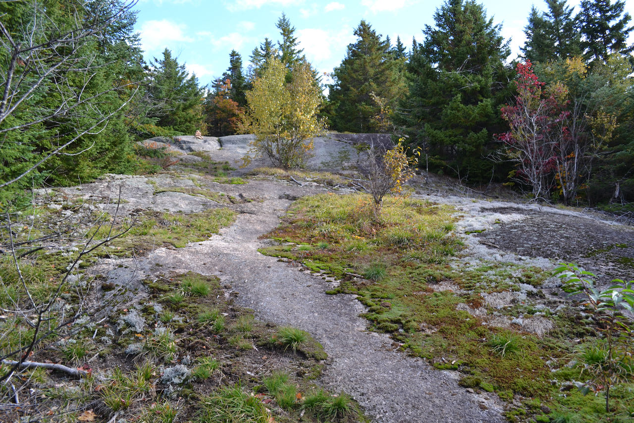
Leaving the parking area, Attitash Trail hops up into the woods on old forest road 230, swings right to cross a small brook in the shadow of a boulder, and climbs gradually. In 0.3 miles from the start, the trail departs the old road, bearing right. Trek into the valley of Louisville Brook for another 0.3 miles, gradually approaching the brook, until some fine ledgy cascades are passed and the trail comes right alongside the water. In a short distance, cross a small tributary joining into the brook and swing left up the side of a small, sharp ridge. The trail ascends moderately through a hardwood valley for 0.6 miles before pausing in the pass between Table Mountain and its taller neighbor Bear Mountain. The trail makes a left turn here to head up the more difficult terrain - a switchback with somewhat loose gravelly footing on a sharp incline. In 0.2 miles, angle up the first open ledge, with nice views of nearby Bear Mountain and some of the Sandwich Range. Continue directly up the ridge back into the forest for a bit, then tackle a tricky rock incline, bringing you out onto more open ledges, where the trail is marked by cairns. Views rise behind you and improve as you ascend over intermittent ledges. The pinnacle of Mt. Chocorua comes into view and you can more clearly make out the shape of the Sandwich Range - Mt. Paugus to the right, followed by Wonalancet Hedgehog, Nanomocomuck Peak, and Mt. Passaconaway. Mt. Tripyramid becomes visible next to Mt. Passaconaway further up. After winding through grassy forest one more time, the trail comes out onto the most expansive ledges of the day, climbing up to the best ledge just 0.3 miles from the first one. Views are excellent, taking in the aforementioned section of the Sanwich Range, as well as more of the eastern spurs of Mt. Chocorua to the left. One winding section of the Swift River is visible in the valley below, with distant Maine hills behind. Furthest over to the left, you look across to the southern portion of the great Moat Mountain ridge. If you wish to visit the summit of the mountain, continue on the trail beyond the ledge for just a short distance and look for a clear but unmarked herd path on the left. Follow the defined path steeply up for less than 0.1 miles to a small clearing in the forest on the highest point.
Printable directions page